Seagrass Scarring Pilot Helps Determine Effective Boater Outreach Methods
Sarasota Bay is shallow, and much of it is covered in seagrass. Seagrasses are aquatic flowering plants that grow in meadows teeming with wildlife. These habitats are very important to our economy and fishing industry, and they provide protection from storms. When boaters run too shallow over seagrass beds, they can rip out grasses and cause propeller scars, or prop scars. Florida is the boating capital of the U.S. With over 40,000 boats registered in Sarasota and Manatee counties, it's important that new and experienced boaters are aware of these habitats and know how to avoid damaging them.
In the fall of 2020, SBEP initiated a seagrass scarring education campaign in Sarasota and Manatee counties. The purpose of this effort was to educate boaters about where seagrasses are in Sarasota Bay, how to avoid scarring them, and what to do in the case of a grounding. To determine the most efficient rollout strategy, a smaller pilot test was done to compare various outreach materials and delivery methods. These materials included:
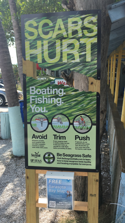
- “Scars Hurt” sign, designed by Florida Sea Grant
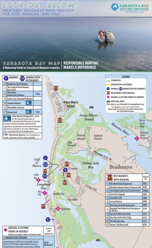
- Waterproof “Sarasota Bay Map and Waterway Guide” available in a box below each sign, and
- How to video, available online and highlighted in each map. Both the video and the map were designed with the input and support of the following organizations: Florida Sea Grant, New College of Florida, Sarasota County, Sarasota Bay Watch, Marina Jack, Sarasota Boat Rental, Island Jet Ski Tours and Rentals, Bradenton Beach Marina, Freedom Boat Club, Evolv Media, Inc., and Cross Ink, Corp.
With the support of a grant from the Manatee County WCIND, the signs and maps were installed in the spring of 2021 in ten initial locations, five in Sarasota County and five in Manatee County. These locations included marinas, boat ramps, boat rental companies, and bait/tackle shops. Several were also chosen due to proximity to seagrass scarring hot spots, which were identified as part of an SBEP-New College project in 2019.
Over a period of six months, SBEP tracked distributor feedback with routine check in calls, visits, and emails; the number of maps distributed; video views; and responses to a boater survey, which was linked via a QR code on every map and map holder.
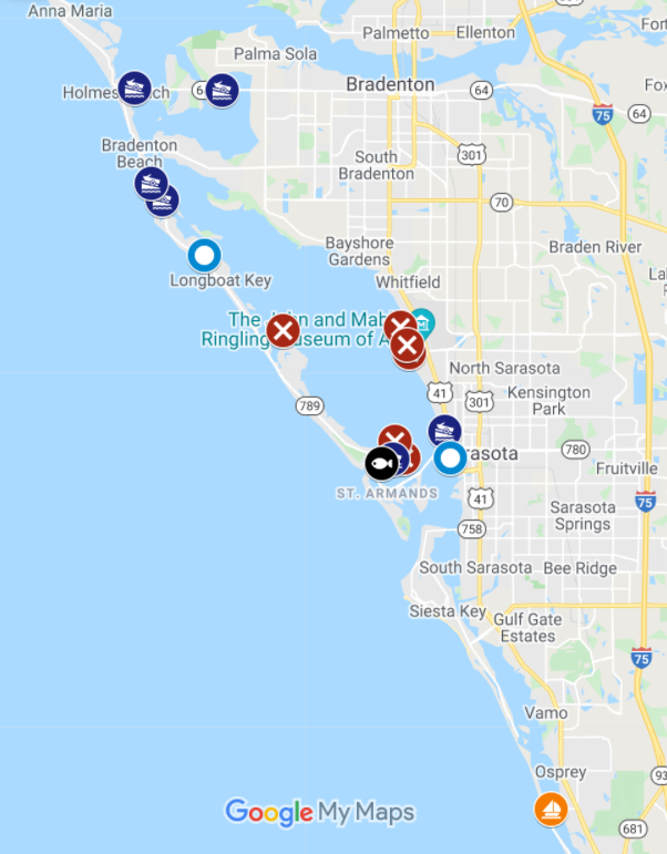
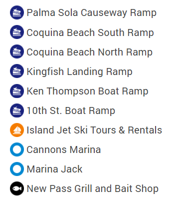
Pilot Test Locations
Scarring Hot Spots

Key Takeaways
Boat ramps had high levels of engagement
Overall, the boat ramps seemed to be the busiest locations (per capita) in terms of outreach materials used and surveys taken. This is possibly due to the fact that every user had to pass by a seagrass sign to use the ramp. Plus, it often takes a little while to load/unload a boat, so other passengers may have had extra time to browse nearby signs and resources. We feel the combination of the sign and the map does well to capture attention at these locations and will prioritize them as this outreach continues to rollout. To reduce the effort and cost of scaling to additional locations, we will also encourage boaters to return their map when they’re done if they don’t need it, somewhat similar to how outdoor community library boxes work.
Sarasota Bay maps were the most used type of material
Based on boater surveys and distributor feedback, the maps seemed to be the most favored material in the outdoor locations tested. The sign was ranked second, and the video last. The popularity of the maps bodes well for future distribution, especially to areas that do not have capacity or desire for a sign. Although it will be interesting to see if displaying the maps by themselves will result in the same level of engagement. It is also important to note that the maps were especially helpful to boat rental companies that don't offer laminated nautical charts or maps, but instead have electronic GPS systems on their boats. The map was also used more at rental companies whose clientele consisted of new boaters or first time customers rather than companies who got repeat customers that knew the bay pretty well.
The video result was not surprising since it was originally intended for indoor trainings or workshops, which could not be included in the pilot due to COVID-19. However, we will continue to look for opportunities to integrate the video into existing boater training programs as well as highlight it on the seagrass maps.
Materials should be available in Spanish
Survey respondents specifically called out for materials to be translated into Spanish. This language option will be integrated as we move forward.
Overall, this exercise has been extremely helpful in prioritizing materials and locations for the rollout of this campaign. We especially want to thank the following organizations for their expertise, input, and support of this outreach initiative: Manatee County WCIND, Manatee County Parks and Natural Resources, City of Sarasota Parks, Sarasota County, Florida Sea Grant, New College of Florida, Sarasota Bay Watch, Marina Jack, Cannons Marina, New Pass Grill and Bait Shop, Sarasota Boat Rental, Island Jet Ski Tours and Rentals, Bradenton Beach Marina, Freedom Boat Club, Evolv Media, Inc., and Cross Ink, Corp.